Three waterfalls, one cloud-forest trail, and a suspension bridge that wobbles just enough to make you grip the cables — the Lost Waterfalls hike outside Boquete is the single best half-day you can spend in the Chiriquí highlands. Here is everything you actually need to know before you go.
Also known as Las Tres Cascadas, the Lost Waterfalls trail sits on a private finca in the Bajo Mono valley north of Boquete town. It is not a wilderness expedition — the path is signed, the entrance is staffed, and you pay a fee at a cabin before you set off. What it is, however, is genuinely spectacular: dense cloud forest, bromeliads draped over every branch, the sound of rushing water building as you climb, and three very different waterfalls waiting at the end of each spur. Almost no guide on the internet has bothered to tell you that each waterfall has a completely different character, a different difficulty to reach, and a different swimming situation. This one does.
Section 01Why do this hike
The Lost Waterfalls trail earns its reputation because it delivers in a short time frame. You can leave Boquete town after breakfast, hike all three falls, swim at the second, and be back for lunch. That is unusual — most truly impressive waterfall hikes in Panama require a full day and a guide. This one does not.
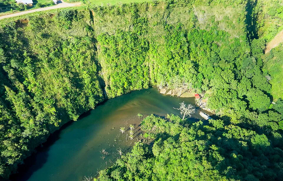
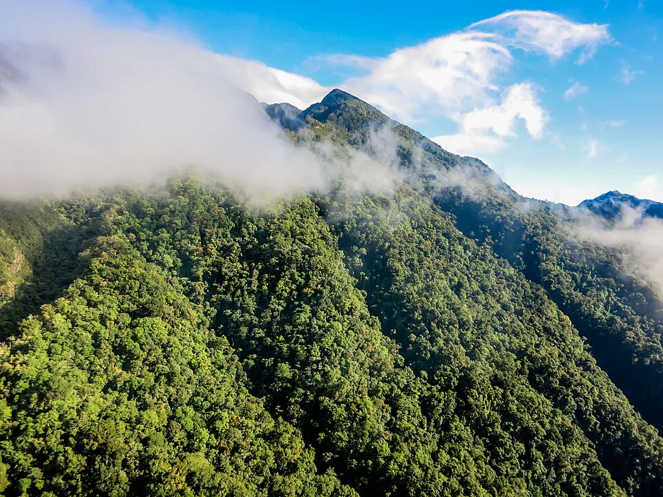
The trail runs through a private cloud forest at roughly 1,400 metres above sea level. Temperatures hover between 16°C and 22°C (60–72°F) even in the dry season, which means hiking is comfortable without the punishing heat of lower-elevation trails. The vegetation is extraordinary: you will walk under a canopy of giant cecropia, pass stands of wild heliconia, and cross root networks so elaborate they function as natural staircases.
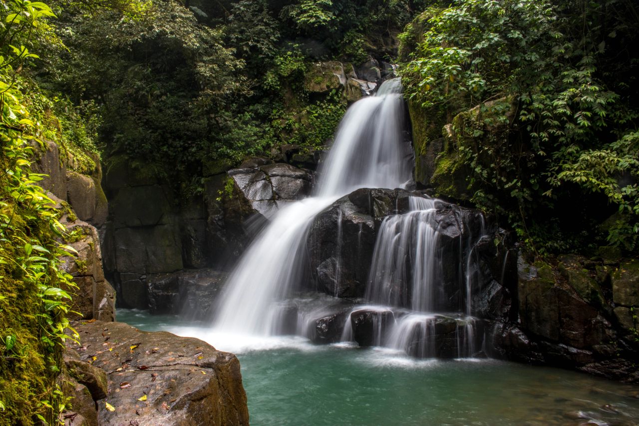
For photographers, the second waterfall — a wide curtain of white water dropping roughly 30 metres into a dark pool — is one of the most photogenic spots in all of western Panama. The light in the morning, when the mist still clings to the canyon walls, is exceptional.
Section 02Trail facts & distance
The trail distance figures quoted online range from 2.1 miles (AllTrails) to 3.2 km (Tourism Panama) to 6 km (Along Dusty Roads). The confusion arises because some sources measure only the trail beyond the ticket cabin, while others include the road walk from the suspension bridge. Here is the breakdown as it actually works on the ground:
- Suspension bridge to ticket cabin: approximately 600 m, steep uphill on a dirt path, 10–15 minutes on foot.
- Cabin to Waterfall 1 (Lower Falls): approximately 700 m, mixed ascent and descent, 20–25 minutes.
- Waterfall 1 to Waterfall 2 (Middle Falls): approximately 500 m, moderate climb, 15–20 minutes.
- Waterfall 2 to Waterfall 3 (Upper Falls): approximately 400 m, steep and technical, 20–30 minutes.
Total round-trip distance from the suspension bridge back to the suspension bridge: approximately 4.4 km (2.7 miles). Total elevation gain from the bridge to the upper falls: approximately 280 metres (920 feet). This is a meaningful climb — not a stroll. Allow 2.5 to 3.5 hours for the full out-and-back at a comfortable pace, including time at each waterfall. Add 30–45 minutes if you plan to swim.
The trail is an out-and-back, not a loop. You retrace your steps to return. One useful tactic: visit Waterfall 1 (Lower Falls) on the way back rather than the way in, since the descent to its viewpoint is easier when approached from above. The trail is well signed throughout with blue wooden arrows — getting lost is genuinely difficult.

Section 03The three waterfalls
Each of the three falls has a distinct personality. Treating them as a single undifferentiated destination — as most guides do — undersells what makes this hike interesting.
Waterfall 1 — Lower Falls (Primera Cascada)
The first waterfall is the tallest of the three, dropping approximately 35–40 metres in a narrow ribbon down a dark basalt cliff face into a deep, narrow canyon. It is dramatic from the viewing platform but inaccessible at the base — the canyon walls are sheer and the pool below is not reachable safely. Swimming: not possible. The viewing platform is excellent for photos. Spend 10 minutes here and move on. On the return, approach from above for a different angle on the falls.
Waterfall 2 — Middle Falls (Segunda Cascada)
The second waterfall is the star of the hike. It fans out across a wide mossy cliff face and drops roughly 25–30 metres into a broad, accessible pool. The pool is approximately 1.5–2 metres deep at its centre and the water temperature is cold — around 16–18°C — but absolutely swimmable. The surrounding clearing is large enough to spread out, and a small cavern sits just to the right of the main curtain of water. Swimming: yes, but stay away from directly beneath the falls — loose rock occasionally falls from the cliff face above. The pool edge and rocks around it are safe for wading and swimming. This is where you should plan to spend the most time. Bring a towel and a dry bag for your phone.
Waterfall 3 — Upper Falls (Tercera Cascada)
The third waterfall is the most secluded and the hardest to reach. The trail between the second and third falls is the steepest section of the entire hike — a rope-assisted scramble over wet roots and slick rock. The payoff is a quieter, more intimate fall dropping into a small, rocky pool. The pool is shallow (roughly 0.5–1 metre) and the rocks around it are uneven. Swimming: technically possible but not recommended — the pool is too shallow for safe diving and the surrounding rocks make entry awkward. The real reward here is solitude: most casual hikers turn back at Waterfall 2, so you will often have Waterfall 3 to yourself. Note that the trail management occasionally closes the upper section for maintenance — ask at the ticket cabin before committing to the full climb.
| Waterfall | Height (approx.) | Swimming | Difficulty to reach |
|---|---|---|---|
| 1 — Lower Falls | 35–40 m | Not accessible | Easy |
| 2 — Middle Falls | 25–30 m | Yes — pool 1.5–2 m deep | Moderate |
| 3 — Upper Falls | 15–20 m | Shallow — wade only | Challenging |
Three rides. One unforgettable Boquete.
Premium Orbea e-bikes that do the climbing for you. Helmet, gloves, water and route support included — and you pay when you arrive.
Coffee Farm E-Bike Tour
Ride to a working farm and see how Geisha — the world's most expensive coffee — is made. Tasting at Altieri Specialty Coffee, geisha ice cream included.
Guided Highlights Ride
Lost Waterfalls, Library Park and the highland viewpoints locals love — the spots most visitors never find.
Self-Paced Rental
Hourly or full-day. Take a recommended route or just wander. The e-bike means hills don't decide your day.
Section 04Seasonal guide
Boquete has two seasons, and they affect the Lost Waterfalls hike in opposite ways. Almost no guide explains the trade-off clearly, so here it is.
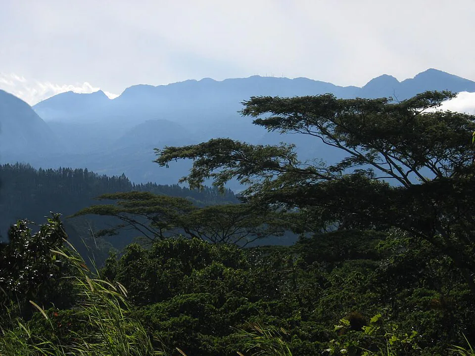
Dry season (December to April): The trail is at its most manageable. The dirt path dries out between rains, the rope sections are less treacherous, and you are far less likely to arrive at Waterfall 3 caked in mud. The downside is water volume — the falls are noticeably less powerful in February and March, particularly Waterfall 1, which can thin to a narrow trickle in a dry year. Waterfall 2 retains good flow even in the dry season because it drains a larger catchment. Visibility is better in the dry season, and you may get cloud-free views of Volcán Barú from the ticket cabin clearing.
Rainy season (May to November): The waterfalls are at their most spectacular. Waterfall 1 becomes a roaring curtain, Waterfall 2 fills its pool to the brim, and the entire forest is an almost fluorescent green. The trade-off is trail conditions: the clay-heavy soil becomes extremely slippery after rain, the rope section between falls 2 and 3 requires real care, and afternoon downpours are almost guaranteed from June through October. If you visit in the rainy season, start by 8 am — you will almost certainly get rained on if you begin after 11 am.
The sweet spot: Late November through January offers the best of both worlds — the rains are tapering off, the trail has not yet dried to dust, and the falls still carry strong flow from the wet season. This is the window most experienced Boquete visitors target.
| Month | Trail condition | Waterfall volume | Verdict |
|---|---|---|---|
| Jan – Mar | Dry, firm | Moderate | Best for hiking |
| Apr | Transitional | Good | Excellent all-round |
| May – Jun | Muddy patches | High | Good with boots |
| Jul – Oct | Very muddy, slippery | Very high | Impressive but tough |
| Nov – Dec | Improving | High | Sweet spot |
Section 05Getting to the trailhead
The trailhead is in the Bajo Mono area, approximately 7 km north of Boquete's central park. The drive takes around 20 minutes. There are three practical options.
| Route | Cost | Time from town | Verdict |
|---|---|---|---|
| Colectivo (Bajo Mono bound) | $2.50 per person | 25–35 min | Cheapest |
| Taxi (shared, 3–4 people) | $10–12 total | 20 min | Best value for groups |
| Private car / rental | Fuel only | 20 min | Most flexible |
Colectivo: Catch the Bajo Mono-bound colectivo from Calle 1a Sur, outside the Casa Bruña supermarket — one block north of Parque José Domingo Médica. The vans run from around 7 am, roughly every 45–60 minutes. Cost is $2.50 per person one way. Tell the driver you want the Lost Waterfalls (Las Tres Cascadas) and they will drop you at the blue wooden sign on the road. The return colectivo can be flagged from the same roadside spot — timing is less predictable, so if you are on a tight schedule, arrange for a taxi to collect you.
Taxi: Any taxi in Boquete town knows the trail. Expect to pay $10–12 for a one-way trip for up to four people. Ask the driver to wait or arrange a pickup time — a round-trip with a 2.5-hour wait typically costs $25–30. This is the most practical option for families or anyone who does not want to worry about return transport.
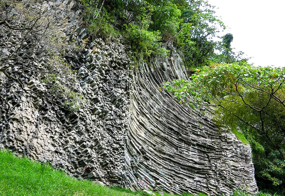
Driving yourself: Head north on the main road out of Boquete toward Bajo Mono. Pass the basalt climbing wall and the old castle. Look for the blue wooden "Tres Cascadas" sign on the right side of the road. Turn right, park near the road, and walk down the short hill to the suspension bridge. There is no formal car park — pull off the road safely.
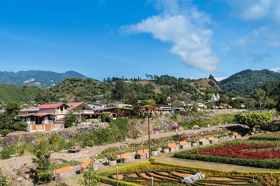
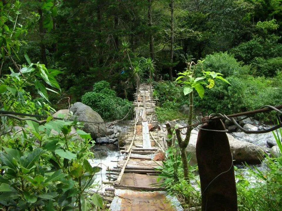
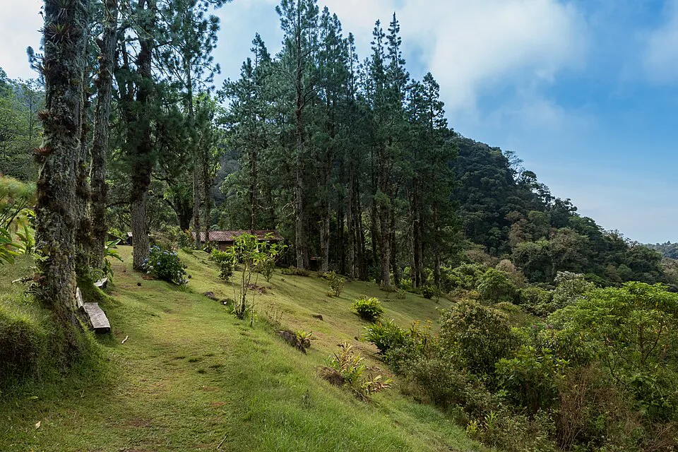
Finding the entrance: From the blue sign, walk down a short hill and cross the wobbly suspension bridge over the Río Palo Alto. On the far side, bear right and follow the signed path uphill for 10–15 minutes to the ticket cabin. The cabin sits in a flower-filled clearing with views of Volcán Barú — it is unmissable.
Section 06Entry fee & hours
The current entrance fee is $10 USD per person. This is a private finca — the land is not a national park — and the fee covers access to all three waterfalls, the maintained trail, and the sign-in/sign-out system that the owners use to track hikers on the trail. There is no additional charge for parking, and guides are not mandatory.
You will be asked to sign a register when you enter and sign out when you leave. This is a genuine safety measure, not a formality — if you have not signed out by closing time, staff will come looking for you. Take it seriously.
Opening hours: 8 am to 5 pm daily. Last entry is at 3 pm. Do not arrive after 3 pm expecting to hike all three falls — you will not have enough time before the trail closes.
Section 07Gear & footwear
Footwear is the single most important decision you will make for this hike. The trail surface is a mix of packed dirt, clay, exposed roots, and wet rock. In the dry season, trail runners with a decent grip sole are adequate. In the rainy season, or any time within 48 hours of significant rain, proper hiking boots with ankle support and a rubber lug sole are not optional — they are necessary. The section between Waterfall 2 and Waterfall 3 involves wet rock scrambling that is genuinely dangerous in smooth-soled shoes. Flip-flops are completely unsuitable for any part of this trail beyond the suspension bridge.
Beyond footwear, pack the following:
- Water: At least 1.5 litres per person. There is no water source on the trail.
- Swimsuit and small towel: For Waterfall 2's pool. A dry bag or zip-lock bag for your phone is worth it.
- Rain jacket or light poncho: Even in the dry season, the cloud forest generates its own weather. Afternoon rain is possible year-round.
- Insect repellent: Mosquitoes are not aggressive on this trail but are present, particularly near the pools.
- Snacks: There is no food available at the trail. Bring something for the return leg.
- Trekking poles (optional): Useful for the steep descent from Waterfall 3 and for anyone with knee issues.
Section 08Wildlife to watch for
The Lost Waterfalls trail passes through cloud forest that sits at the lower edge of the quetzal's range. Resplendent quetzals are occasionally spotted near the trail, particularly between January and April when males are in full breeding plumage with their extraordinary tail feathers. Your chances are better on the Pipeline Trail or the Quetzal Trail at higher elevation, but do not rule out a sighting here — scan the wild avocado trees near the upper section of the trail.
More reliably, you will encounter:
- Collared trogons — a close relative of the quetzal, common along the trail, with vivid red and green plumage. Look for them perched motionless in the mid-canopy.
- Keel-billed toucans — often heard before they are seen, their frog-like croaking carries through the forest. They favour the canopy near the ticket cabin clearing.
- Clay-coloured thrush — Panama's national bird, abundant and vocal throughout the trail.
- Longhorn beetles — enormous and spectacular, frequently seen sunning themselves on rocks near Waterfall 2. Do not be alarmed; they are harmless.
- Two-toed sloths — occasionally spotted in the cecropia trees along the lower section of the trail. Look for a dark, unmoving mass in the canopy.
- Howler monkeys — more often heard than seen. Their roar carries for kilometres and is one of the more startling sounds in the cloud forest if you have not heard it before.
The trail is also rich in amphibians — look for red-eyed tree frogs and glass frogs near the pools and stream crossings, particularly in the early morning and after rain. Bring binoculars if you have them; the forest rewards patience.
Section 09Guided vs. self-guided
The short answer: most people do not need a guide for this trail. It is well-signed, the route is straightforward, and the ticket cabin staff will brief you on conditions before you set off. A guided tour adds cost — typically $35–50 per person through agencies in Boquete — but does add value if you are serious about wildlife identification. A good naturalist guide will spot birds and insects you would walk straight past, and will know which sections to take slowly after rain.
If you want a guided experience, book through a reputable Boquete operator rather than accepting an offer from someone approaching you in the street. Boquete Outdoor Adventures and several other established agencies run regular Lost Waterfalls tours. Expect the guided version to take 3–4 hours including transport.
For most independent travellers, the self-guided approach is the right call. Arrive at the ticket cabin by 9 am, sign in, ask the attendant about current trail conditions (especially the upper section), and set off. The signs are clear enough that you will not need a map.
Section 10Combine with a coffee ride
The Lost Waterfalls hike fits neatly into a half-day, which leaves the afternoon free for Boquete's other signature experience: exploring the coffee farms of the Bajo Mono and Jaramillo valleys. The same road that takes you to the trailhead passes through some of the finest coffee-growing terrain in Central America — small-batch farms growing Geisha and Typica varietals at altitude, with views of Volcán Barú as a backdrop.
One of the most satisfying ways to link these two experiences is by e-bike. E-Valley Bikes operates guided and self-guided e-bike tours out of Boquete that cover the highland roads above town — the same roads that lead toward the Lost Waterfalls trailhead. The electric assist makes the climb out of the valley manageable for riders of any fitness level, and the descent back into town is genuinely exhilarating. A morning hike to the falls followed by an afternoon coffee farm e-bike tour makes for one of the best full days in Chiriquí.
Alternatively, if you are driving yourself to the trailhead, stop at Finca Lerida or Café Ruiz on the way back — both offer tours and tastings, and both sit within a few kilometres of the Lost Waterfalls access road. The combination of cold waterfall pool and hot single-origin pour-over is, frankly, hard to beat.