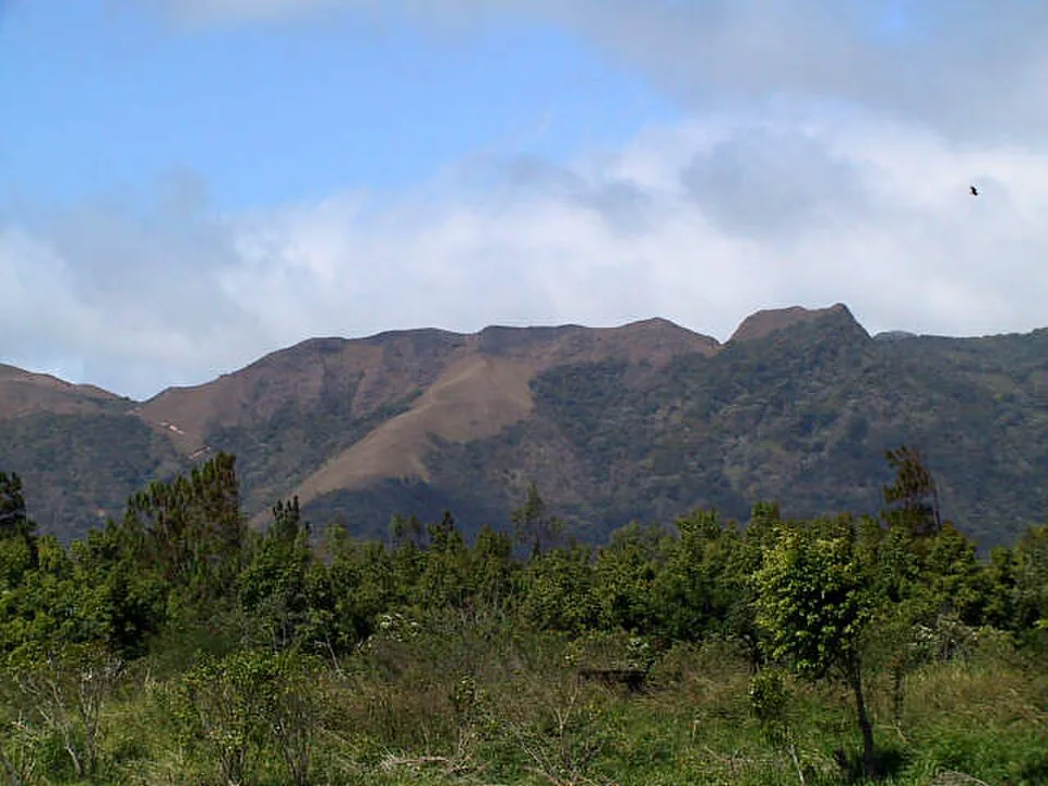
El Valle de Antón sits inside the caldera of a volcano that last erupted 300,000 years ago. The crater walls are the trails. Every hike here climbs the rim of something ancient, and the views — valley floor to cloud forest to Pacific lowlands — are unlike anything else two hours from Panama City.
This guide covers every significant trail in El Valle with the specifics that other guides skip: exact elevation gains, seasonal mud levels, which waterfalls you can actually swim in, where to get dropped off by bus, and what wildlife to expect on each route. Whether you have one morning or four days, you will leave knowing exactly which trail to start with and what you are getting into.
Section 01Why El Valle beats most Panama hiking destinations
El Valle sits at roughly 600 meters above sea level inside a caldera approximately 6 kilometers wide. The elevation keeps temperatures 5–8°C cooler than Panama City, which means you can actually hike at midday without suffering. The volcanic soils support three distinct forest types — tropical dry, premontane wet, and cloud forest — within a few kilometers of each other, which is why the biodiversity here is extraordinary for such a compact area.
The trail network is dense and largely walkable from the town center. You do not need a car to reach most trailheads. The entrance fees are minimal — $1 to $3 per trail — and the trails range from a 45-minute summit scramble to a full-day ridge traverse. Cerro Gaital Natural Monument adds a protected cloud forest layer that most visitors never reach, which means genuine solitude is still possible on a Tuesday morning.
For hikers comparing Panama destinations: El Valle is better than Boquete for accessibility and trail variety at a low price point, but Boquete's Volcán Barú offers the only summit in Panama from which you can see both oceans on a clear day. El Valle wins on waterfall density, hot springs, and the sheer novelty of hiking a volcano caldera rim. We cover the comparison in more detail at the end of this guide.
Section 02La India Dormida — the signature hike
La India Dormida is the hike that defines El Valle. From the town center, look north toward the crater wall and you can make out the silhouette of a woman lying on her back — the profile of her face, chest, and feet formed by successive ridgelines. The legend tells of an indigenous girl named Flor del Aire who fell in love with a Spanish conquistador and, heartbroken when he left, turned to stone on the crater rim. The trail follows that silhouette.
Trail specs
- Distance: 3.2 km one-way to summit (Piedra Pintada trailhead); full loop via Cerro La Cruz adds 3–4 km
- Elevation gain: 273 m (895 ft) to the main summit; full ridge traverse to Cerro La Cruz reaches approximately 453 m (1,486 ft) total gain
- Duration: 45–60 min to summit; 3–4 hours for the full loop
- Difficulty: Moderate. The first kilometer is deceptively flat through jungle. The second kilometer is steep and rocky, with exposed root sections that become slippery when wet. No technical scrambling required, but sure footing is essential.
- Entrance fee: $3
- Trailhead GPS: 8.6089° N, 80.1272° W (Piedra Pintada entrance, ~10–15 min walk from town center)
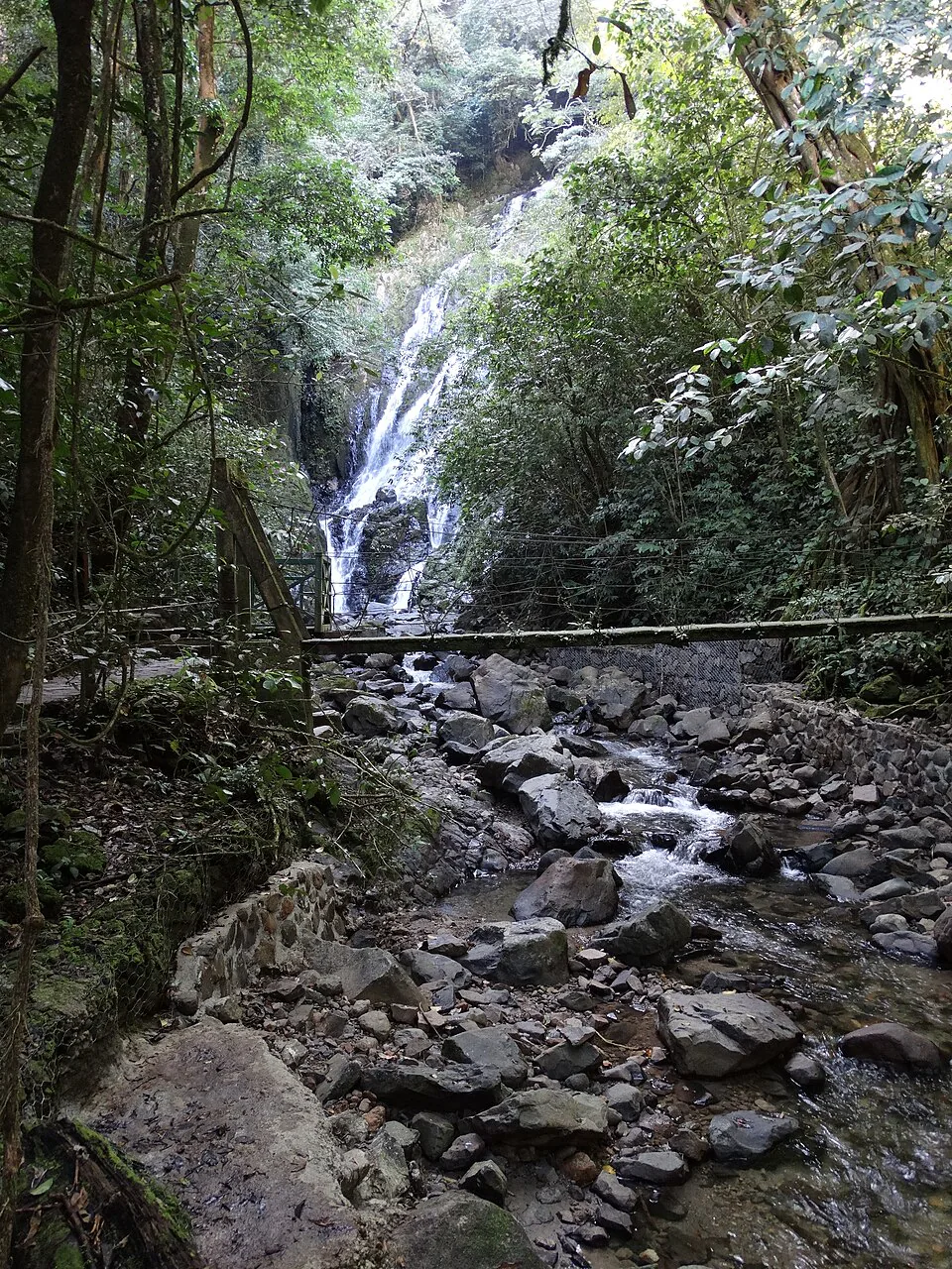
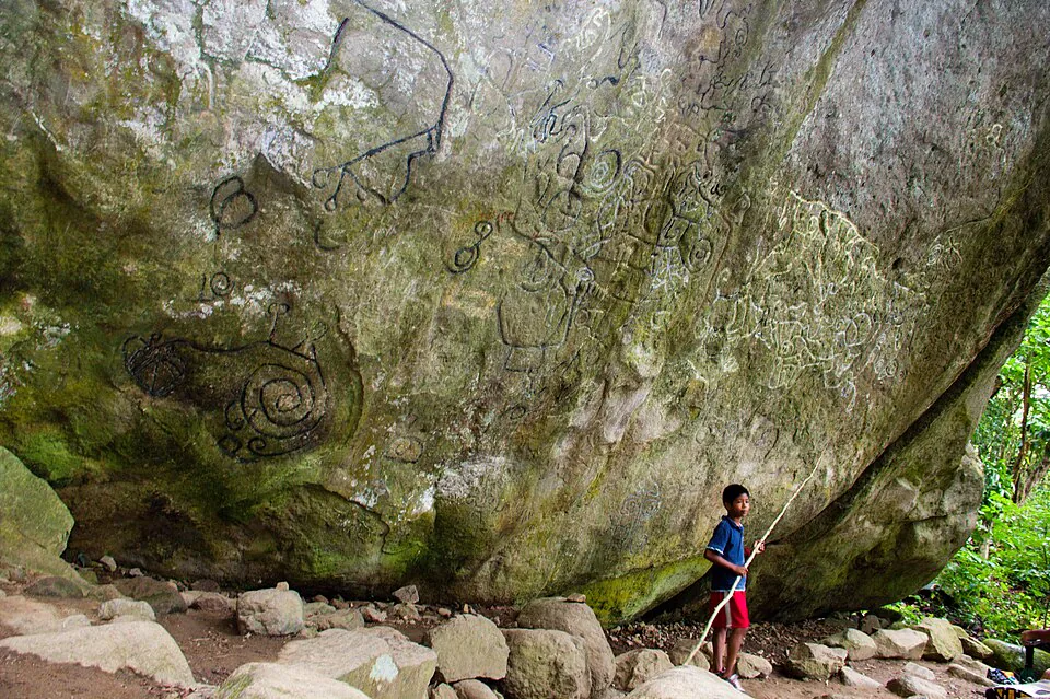
The trail begins at Piedra Pintada, named for a massive pre-Columbian boulder covered in petroglyphs — geometric spirals and figures carved by the Coclé people centuries before Spanish contact. It is worth pausing here before the climb. The rock sits beside a stream and the carvings are best seen in morning light.
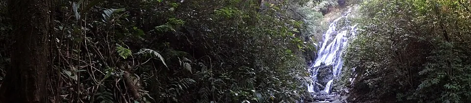
From Piedra Pintada the path enters dense jungle on a concrete-reinforced section before transitioning to raw earth. The ascent steepens quickly. There are three waterfalls accessible on the way up — the first two are small cascades good for splashing your face, the third is a proper swimming hole about 8 meters wide with a 4-meter drop. The water is cold and clean. Bring a swimsuit if you plan to use it on the descent.
At the summit ridge the forest opens completely. To your left: the entire valley floor laid out below, the town grid visible, the Sunday market a colored patchwork. To your right: unbroken jungle dropping toward the Pacific lowlands. The ridge walk itself — "The Edge of India" — continues over a series of peaks. Follow the arrows painted on rocks; do not turn left or right at junctions unless you are doing the full loop.
Full loop option: La India Dormida to Cerro La Cruz
Instead of returning the way you came, continue along the ridge to Cerro La Cruz, a large cross on a viewpoint popular with locals at sunset. Total distance adds 3–4 km and 180 m additional elevation. At Cerro La Cruz the trail meets the road connecting El Valle to Antón — buses pass occasionally, or it is a 30-minute walk back to town through the cemetery road. If you continue past the cross, a descent trail leads to Chorro Las Mozas, a series of swimming pools on the Antón River. This makes for an excellent full-day circuit: summit at sunrise, ridge walk, waterfall swim, back to town by noon.
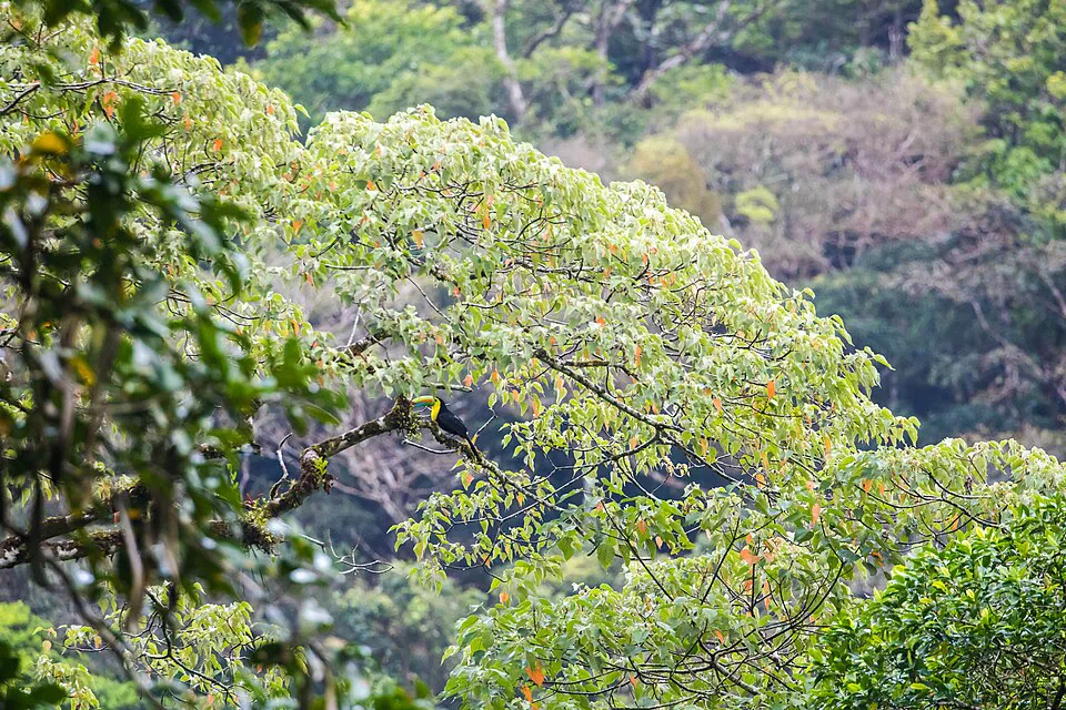
Wildlife on La India Dormida
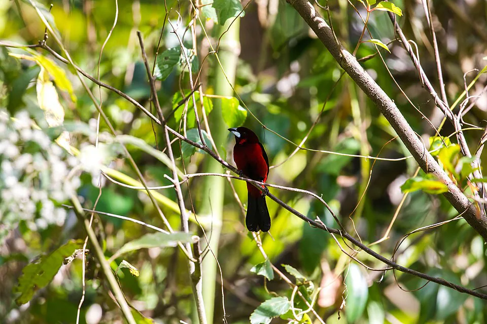
The jungle section below the summit is the best place in El Valle to spot toucans (keel-billed and collared aracari), motmots, and tanagers. Early morning — before 7 a.m. — is peak activity. The ridge itself hosts raptors: look for white hawks and broad-winged hawks riding thermals off the crater wall between 8 and 10 a.m. Howler monkeys are audible from the trailhead most mornings; you may see them in the canopy on the lower section.
Section 03Waterfall hikes — Chorro El Escondido, Chorro de Paz & San Juan
El Valle has more accessible waterfalls per square kilometer than almost anywhere else in Panama. Here are the three worth hiking to specifically, with honest assessments of what you will find.
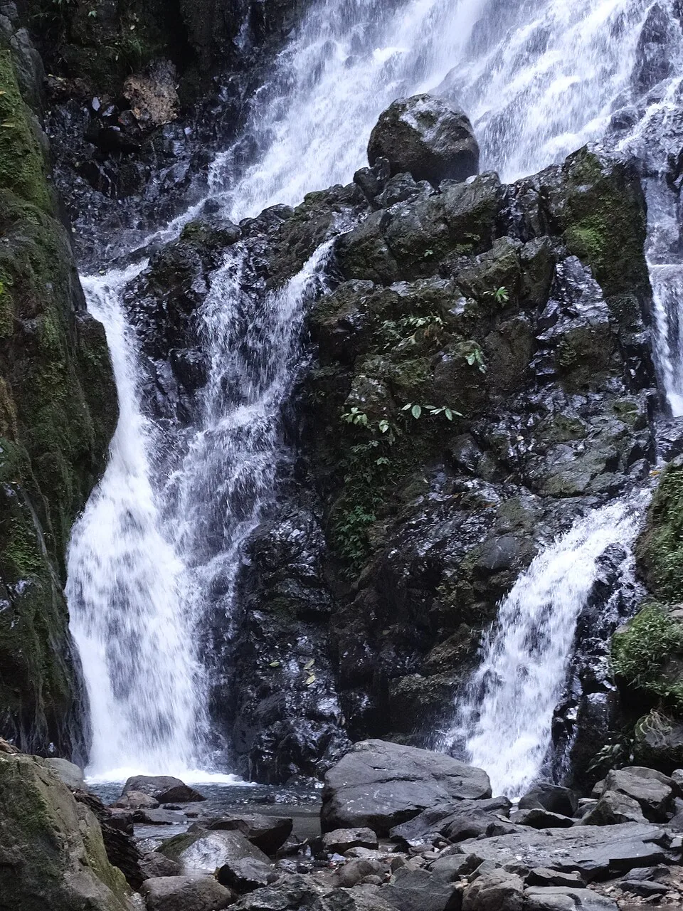
Chorro El Escondido (The Lovers Falls / The Hidden Waterfall)
- Distance: 3.2 km round trip
- Elevation gain: ~180 m (590 ft)
- Duration: 1.5–2 hours
- Difficulty: Moderate to hard. The trail is well-maintained in its upper section but involves stream crossings — up to four in wet season — and a steep final approach over slick rocks.
- Entrance fee: $2
- Swimmable: Yes. The pool at the base is approximately 3 meters deep and 6 meters wide. Current is manageable in dry season; avoid swimming here after heavy rain — the flow increases dramatically and the pool fills with debris.
- Trailhead GPS: 8.6021° N, 80.1198° W (southeastern edge of town, accessible by foot or taxi)
The waterfall itself drops about 15 meters over a smooth volcanic rock face into a clear pool. In dry season (January–April) the flow is moderate and the pool is calm enough for a comfortable swim. In wet season the falls roar and the approach trail becomes genuinely muddy — knee-deep in sections after sustained rain. The name "Lovers Falls" comes from local legend; locals also call it Chorro El Escondido (the hidden waterfall) because it is not visible until you are standing directly in front of it.
Chorro de Paz
A smaller, quieter waterfall on the western side of the valley. The trail is approximately 2 km round trip with minimal elevation gain — essentially flat through farmland and secondary forest. The falls are about 8 meters high and the pool is shallow (1–1.5 m), more suitable for wading than swimming. This is the right choice for families with young children or anyone wanting a short, easy walk with a scenic payoff. Entrance is $1. No formal trailhead — ask at any accommodation for current directions, as the access path shifts slightly with the seasons.
San Juan Waterfall (Chorro Las Mozas)
Technically the terminus of the La India Dormida full loop, Chorro Las Mozas sits on the Antón River and consists of a series of tiered pools rather than a single dramatic drop. The water is cool and clear, the pools are 1–2 meters deep, and on a weekday you may have the place entirely to yourself. Accessible as a standalone hike (approximately 1.5 km from the road near Cerro La Cruz) or as the finale of the full ridge traverse. No entrance fee for the river pools themselves.
| Waterfall | Distance RT | Swim? | Difficulty | Best season |
|---|---|---|---|---|
| Chorro El Escondido | 3.2 km | Yes (dry season) | Moderate–Hard | Jan–Apr |
| Chorro de Paz | 2 km | Wade only | Easy | Year-round |
| Chorro Las Mozas | 3 km (from Cruz) | Yes | Easy–Moderate | Year-round |
| La India Dormida falls | On trail | Yes (pool 3) | Moderate | Jan–Apr |
Four ways to do El Valle by bike.
Self-guided freedom with a GPS audio guide that does the narrating — no group, no fixed itinerary. Helmet, lock and front basket included.
Town & Art Loop
Historic center, the artisan market and the church. Flat, easy, perfect for a first ride.
Falls & Wildlife
Chorro El Macho waterfall, the Butterfly Haven and the Níspero Zoo. Built for groups with kids.
Crater Ridge
Up to the panoramic ridge over the crater. The sunset slot is the one to book.
Mountain & India Dormida
Off-road, real elevation, real views — for experienced riders who want to earn it.
Section 04Cerro Gaital — the cloud forest summit
Cerro Gaital is the hardest and most rewarding hike in El Valle. It sits within the Cerro Gaital Natural Monument, a protected cloud forest reserve on the northern rim of the caldera. The summit at approximately 1,185 meters is the highest accessible point in the valley and the only place where you genuinely enter cloud forest — moss-draped trees, bromeliads, orchids, and a silence that feels earned.
Trail specs
- Distance: 7.4 km round trip (4 km to summit from the monument gate)
- Elevation gain: ~580 m (1,900 ft) from the gate
- Duration: 4–5 hours round trip
- Difficulty: Hard. The first 2.5 km are easy to moderate — a wide track passing remote farmhouses. The final 1.5 km to the summit involve steep, muddy switchbacks, exposed roots, and one section of hands-on-rock scrambling approximately 10 meters long. Fit hikers with trail experience only.
- Entrance fee: $1 (monument gate; gate is sometimes unstaffed — you can pass under the fence to the right if locked, as many hikers do)
- Trailhead access: Take the local bus toward La Mesa / Anton Valley from the town center ($1). Ask the driver to drop you at the Cerro Gaital trailhead. The bus runs roughly every 30–45 minutes. Alternatively, the trailhead is a 45-minute walk from town along the main road — worth doing if you want to maximize wildlife spotting on the approach.
- Trailhead GPS: 8.6312° N, 80.1189° W
The summit viewpoint is a small clearing between trees where the cloud forest opens just enough to reveal the valley below and, on clear days, the Pacific coast. You will likely be standing in cloud — which is part of the appeal. The forest on the upper section is dense with epiphytes and the trail is often overgrown in wet season. In April 2022 the upper section was reportedly blocked and required bushwhacking; conditions vary. Check with local guides or your accommodation before attempting the summit push.
Wildlife on Cerro Gaital
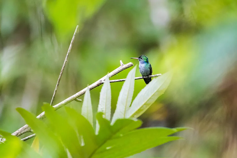
The monument protects habitat for over 300 bird species. Specific targets: resplendent quetzal (March–May, upper cloud forest), emerald toucanet, violet sabrewing hummingbird, and spotted barbtail. Mammals include white-nosed coati, Geoffrey's tamarin, and — rarely — ocelot. The lower farmhouse section is excellent for raptors and open-country birds. Start before 6 a.m. for the best wildlife activity.
Section 05Hot springs — Pozos Termales de El Valle
The hot springs at El Valle are not a luxury spa. They are a concrete-lined series of pools fed by geothermally heated groundwater, run by a local cooperative, and visited equally by Panama City weekenders and local families. That is precisely what makes them worth going to.
- Location: On the slopes of Cerro Cara Iguana, approximately 1.5 km from the town center. Walkable in 20 minutes or reachable by taxi for $2.
- GPS: 8.5981° N, 80.1342° W
- Hours: Daily 8 a.m. – 5 p.m.
- Entrance fee: $3–5 depending on current management (fees have fluctuated; bring cash)
- Water temperature: The pools range from approximately 30°C to 38°C (86–100°F). The hottest pool is the smallest and sits closest to the hillside. The larger pools are cooler and more suitable for extended soaking.
- Mud treatment: Natural volcanic mud is available at the site. Locals apply it liberally, let it dry, and rinse in the cooler pools. It genuinely leaves skin feeling smoother. There is no charge beyond the entrance fee.
The hot springs are best visited in the late afternoon, after a morning hike, when the air temperature drops and the contrast between the warm water and cool mountain air is most pronounced. Avoid Sunday afternoons in high season — the pools fill with day-trippers from Panama City and the experience degrades significantly. A Tuesday or Wednesday morning visit is almost meditative.
Section 06More trails — Cerro La Silla, Cerro Cara Iguana & Pozo Azul
Cerro La Silla
La Silla (the saddle) is a rolling ridge hike along grassy hills with sweeping views of the valley. It is the most photogenic hike in El Valle that does not require significant fitness. The trail traverses open grassland and secondary forest along a ridgeline that genuinely resembles the Scottish highlands — an unexpected landscape inside a tropical volcano.
- Distance: 6–8 km depending on how far along the ridge you go
- Elevation gain: ~300 m (984 ft)
- Duration: 2.5–4 hours
- Difficulty: Moderate. The approach road is rough — 4WD recommended if driving. Most visitors arrange transport with a local guide or take a taxi to the trailhead (approximately $8–10 one-way). The trailhead is 15–20 minutes from town by vehicle.
- Entrance fee: None
Cerro Cara Iguana
The iguana-face mountain is visible from the town center and the trail to its ridge is one of the more demanding day hikes in the valley. The 9.2 km route (4–4.5 hours, hard) gains approximately 400 m and involves steep rocky sections and exposed scrambling near the top. The views from the ridge are exceptional — arguably better than La India Dormida because you see the entire caldera wall from a different angle. Trailhead is a 20-minute walk from town center; no entrance fee.
Pozo Azul Canyon
Pozo Azul is less a hike than a canyon scramble — you wade and swim through a narrow gorge with turquoise pools, following the river upstream. The water is cold (around 22°C), the canyon walls are close, and the experience is genuinely thrilling. It requires comfort in water and the ability to climb over wet boulders. Duration: 1.5–2 hours. Entrance fee: $3. A local guide is strongly recommended for first-timers — the route is not marked and the water depth varies. Ask at Bodhi Hostel or the Golden Frog Inn for current guide recommendations.
Section 07Seasonal conditions — when to hike El Valle
El Valle's dry season runs roughly December through April. Wet season runs May through November, with the heaviest rainfall in October and November. The distinction matters enormously for trail conditions.
| Month | Conditions | Waterfalls | Mud level | Verdict |
|---|---|---|---|---|
| Jan–Apr | Dry, sunny mornings, cool nights | Moderate flow, swimmable | Low | Best hiking |
| May–Jun | Rain begins, still manageable | High flow, impressive | Medium | Good with prep |
| Jul–Aug | Consistent afternoon rain | Very high, powerful | High | Ridge hikes OK |
| Sep–Nov | Heaviest rain, trails saturated | Flood risk on approach trails | Very high | Experienced only |
| Dec | Drying out, occasional showers | Good flow | Low–medium | Underrated month |
A few specifics that competitors never mention: La India Dormida's ridge is exposed and can be genuinely dangerous in high winds, which occur most frequently in January and February. If you arrive at the summit and the wind is strong enough to affect your balance, turn back — the ridge drops steeply on both sides. Cerro Gaital's upper section becomes nearly impassable in sustained wet season rain; the clay soil turns to a slip-and-slide. Pozo Azul Canyon should never be attempted in or after heavy rain — flash flooding in the gorge is a real risk.
Wildlife viewing peaks in the wet season (May–October) when migrants arrive and breeding activity increases. If you are primarily a birder, a wet-season visit with proper rain gear is worth the mud. The quetzal window (March–May) overlaps perfectly with the tail end of dry season and the start of wet — ideal conditions for both hiking and birding.
Section 08Getting to trailheads — buses, taxis & e-bikes
El Valle's town center is the hub. Most trailheads are within 2 km of the central market, which means you have genuine options for getting around without a car.
| Trailhead | From town center | Transport options | Cost | Notes |
|---|---|---|---|---|
| La India Dormida (Piedra Pintada) | 10–15 min walk | Walk, taxi, e-bike | Free / $2 taxi | Most accessible |
| Cerro Gaital | 45 min walk or bus | Local bus (La Mesa route), walk, taxi | $1 bus / $5 taxi | Bus every 30–45 min |
| Cerro La Silla | 15–20 min by vehicle | Taxi, guided tour, 4WD | $8–10 taxi one-way | Road is rough |
| Cerro Cara Iguana | 20 min walk | Walk, e-bike | Free | No entrance fee |
| Pozos Termales | 20 min walk | Walk, taxi, e-bike | Free / $2 taxi | Combine with Cara Iguana |
| Chorro El Escondido | 20–25 min walk | Walk, taxi | Free / $3 taxi | Muddy road in wet season |
| Pozo Azul | 30 min walk or bus | Walk, local bus, taxi | $1 bus / $5 taxi | Guide recommended |
One genuinely useful option for covering multiple trailheads in a single day: rent an e-bike. E-Valley Bikes operates guided e-bike tours in El Valle that pair cycling between trailheads with short hikes — a practical way to visit the hot springs, a waterfall, and a viewpoint without burning your legs before you even start climbing. For hikers who want to combine the valley's cycling routes with its trails, it is the most efficient format available and keeps the carbon footprint minimal.
For the La India Dormida sunrise hike specifically: walk to the Piedra Pintada trailhead the night before to confirm the route, then leave your accommodation at 4:30–4:45 a.m. with a headlamp. The walk to the trailhead is safe and well-lit along the main road.
Do you need a guide? For La India Dormida, Cerro Cara Iguana, and the hot springs: no, guides are not required and the trails are adequately signed. For Cerro Gaital's upper section and Pozo Azul Canyon: a local guide is strongly recommended, particularly in wet season. Certified guides can be arranged at the La India Dormida trailhead entrance ($15–25 per person) or through your accommodation. Mario Urriola is a well-regarded local birding guide who also covers the main hiking trails.
Section 09What to bring — packing list and practical notes
El Valle's trails punish the underprepared in specific ways. Here is what actually matters:
- Footwear: Trail runners with grip are sufficient for dry season. In wet season, waterproof hiking boots are essential for Cerro Gaital and Chorro El Escondido. Flip-flops will get you hurt on the La India Dormida ascent.
- Water: Carry at least 1.5 liters per person for any hike over 2 hours. There are no reliable water sources on the trails — stream water should be treated before drinking. The summit of La India Dormida has no shade and no water.
- Sun protection: The ridge trails are fully exposed. SPF 50 and a hat are not optional. The crater's elevation means UV exposure is higher than at sea level.
- Insect repellent: DEET-based repellent is recommended for the jungle sections, particularly in wet season. Mosquitoes are not a major issue on the exposed ridges but are present in the lower forest sections and near the waterfalls.
- Headlamp: Essential for the La India Dormida sunrise hike. A phone flashlight is not adequate for the rocky sections in the dark.
- Cash: All entrance fees are cash only. Bring small bills. The ATMs in town (Banco Nacional and Caja de Ahorros) occasionally run out on weekends.
- Swimwear: If you plan to use the waterfall pools or hot springs, bring a swimsuit. Hiking in wet clothes for the descent is uncomfortable and increases blister risk.
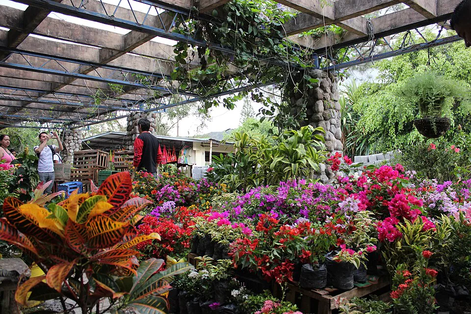
- Snacks: There are no food vendors at any trailhead. Pack enough for your planned duration plus an extra hour. Bananas and granola bars from the Sunday market are ideal.

Section 10El Valle vs Boquete — which is right for you
Both destinations are Panama's premier highland hiking areas. They are genuinely different experiences and the right choice depends on what you want.
| Factor | El Valle de Antón | Boquete | Edge |
|---|---|---|---|
| Distance from Panama City | 2–2.5 hrs | 6–7 hrs (or fly) | El Valle |
| Summit hike | Cerro Gaital (1,185 m) | Volcán Barú (3,475 m, see both oceans) | Boquete |
| Waterfall density | High — 4+ swimmable | Moderate — Lost Waterfalls trail | El Valle |
| Hot springs | Yes, in-town | Yes, but farther out | El Valle |
| Coffee culture | Minimal | World-class, Geisha origin | Boquete |
| Birding | Excellent (300+ spp) | Exceptional (quetzal, 400+ spp) | Boquete slight edge |
| Budget | Very low ($1–5 trail fees) | Moderate ($10–30 guided tours) | El Valle |
| Crowds | Moderate weekends | Higher year-round | El Valle |
The honest summary: El Valle is the better choice for a weekend trip from Panama City, for budget-conscious hikers, for families, and for anyone who wants waterfall swimming and hot springs alongside their trail time. Boquete is the better choice for serious altitude hikers, specialty coffee enthusiasts, and anyone targeting the Barú summit. If you have ten days in Panama, do both — they are complementary, not competing.
One thing both destinations share: e-bikes are an increasingly popular way to explore the valleys between hikes. In Boquete, E-Valley Bikes has established a reputation for well-maintained electric bikes and guided routes that connect the highland towns and coffee farms. The same logic applies in El Valle — cycling the flat valley floor between trailheads on an e-bike is genuinely more enjoyable than waiting for the local bus, and it leaves your legs fresher for the actual climbing.