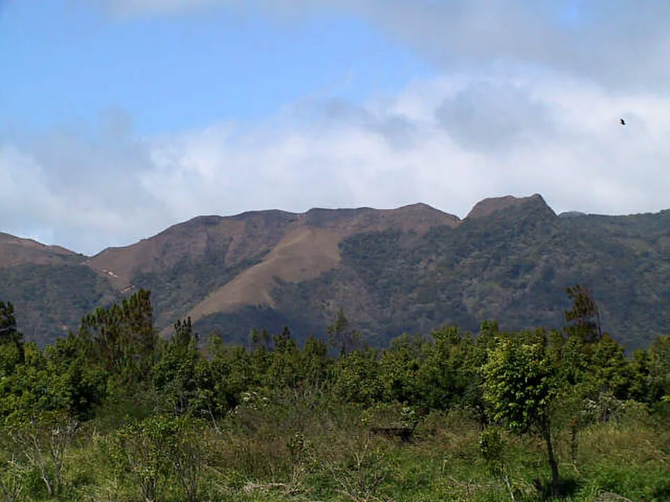
La India Dormida is the hike that defines El Valle de Antón. From the valley floor you can see her silhouette — a woman lying on her back along the crater rim — and within two hours you can be standing on top of her. The views are extraordinary. The trail is genuinely interesting. And almost every guide online gets at least one key detail wrong.
This guide fixes that. It covers all three route options with honest distances, explains what the petroglyphs at Piedra Pintada actually are, gives you exact sunrise departure times by season, and tells you which months the trail turns into a mud chute. It also tells you when to skip the crowds, where the natural pools are, and how the India Dormida hike stacks up against every other trail in El Valle.
Section 01Why this hike is worth your morning
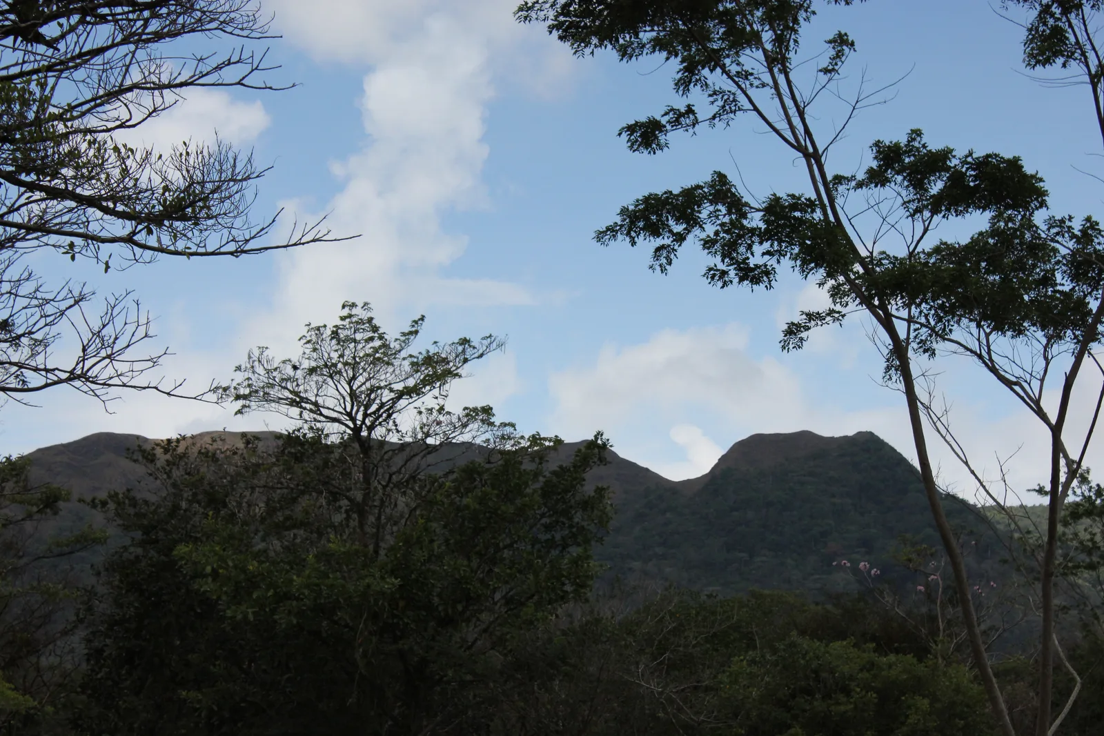
El Valle de Antón sits inside the caldera of a volcano that last erupted roughly 300,000 years ago. The town is at around 600 metres above sea level — noticeably cooler than Panama City — and the crater walls rise sharply on all sides. La India Dormida is the most prominent of those walls, a ridgeline that runs roughly east to west along the northern edge of the caldera. When you stand on the ridge, the entire valley spreads out below you to the south: the town grid, the Sunday market, the patchwork of farms and forest. To the north, you look down into dense jungle falling away toward the lowlands. It is one of the most complete panoramas in central Panama, and you earn it in under an hour of hard climbing.
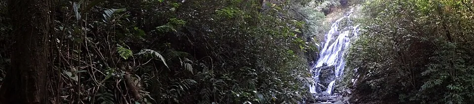
The trail is not just a viewpoint hike. It passes two waterfalls, a set of pre-Columbian petroglyphs that are among the most accessible in the country, and a ridgeline section where the vegetation drops away entirely and you walk exposed grassland with nothing but wind and sky. On a clear dry-season morning, you can see all the way to the Pacific. That combination — archaeological site, cloud forest, open ridge, crater views — in a 3.5 to 6 km package is hard to beat anywhere in Panama.
Section 02The legend behind the name
The name La India Dormida — The Sleeping Indian Girl — comes from a local legend tied to the era of Spanish colonisation and indigenous resistance. The story centres on Flor del Aire (sometimes called Luba), the youngest daughter of Chief Urraca, the Ngäbe warrior chief who led one of the most sustained and successful resistances against Spanish forces in the Americas during the early 16th century. Urraca was never fully conquered; the Spanish eventually signed a peace agreement with him rather than continue a war they were losing.
In the legend, Flor del Aire fell in love with a young Spanish soldier — a forbidden relationship given the ongoing conflict between her people and the colonisers. A warrior from her own tribe named Yaravi also loved her, but his feelings were not returned. Unable to bear the rejection, Yaravi threw himself from the mountain ridge, dying on the rocks below while Flor del Aire watched. Overcome with grief and guilt, she lay down on the ridge and never rose again — her body becoming the mountain itself, her silhouette visible from the valley forever after.
The legend is significant beyond its romantic surface. Chief Urraca is a genuine historical figure, a national hero in Panama whose image appears on the 1-balboa coin. The story of Flor del Aire encodes the real tension of that period: the collision between indigenous communities and Spanish colonisers, the complexity of relationships across those lines, and the landscape as a kind of living memory. When you look up at the ridge from town, you are looking at a story that Panamanians have been telling for five centuries.
Section 03The three routes — and which one to choose
There is genuine confusion online about the distance and format of this hike because there are three distinct route options, all starting from the same trailhead. Here is a clear breakdown.
| Route | Distance | Time | Difficulty | Verdict |
|---|---|---|---|---|
| Figure-of-Eight (out-and-back) | ~3.2 km | 1.5–2.5 hrs | Moderate | Best for first-timers |
| Cerro La Cruz Loop | ~3.5 km | 2–3 hrs | Moderate | Best overall circuit |
| Full Caldera Route (to Chorro Las Mozas) | ~6 km point-to-point | 4–6 hrs | Moderate–Hard | Best for strong hikers |
Figure-of-Eight / Out-and-Back (~3.2 km): You ascend via the Piedra Pintada entrance, pass the petroglyphs and both waterfalls, reach the India Dormida summit, and return the same way. The "figure-of-eight" refers to a small loop variation just before the summit where the trail briefly splits and rejoins — both paths converge at the same point, so it does not matter which branch you take. This is the right choice if you are short on time, doing a sunrise hike, or simply want the views without a long day out. Total elevation gain is approximately 273–283 metres.
Cerro La Cruz Loop (~3.5 km): Same ascent as above, but instead of returning the way you came, you continue along the ridge past the India Dormida summit to the Mirador Cerro La Cruz — a cross-topped viewpoint that looks out over the road connecting El Valle to Antón. From there you descend back into town via a different path, completing a loop. This is the most satisfying option: you see more of the ridge, get a second distinct viewpoint, and avoid retracing your steps on the steep forest section. The descent from Cerro La Cruz is less technical than the main ascent.
Full Caldera Route (~6 km, point-to-point): This is the official "Caldera Route" that forms part of El Valle's wider 30 km trail network. You continue past Cerro La Cruz, descend the Cerro Violín trail, and finish at the Antón River near Chorro Las Mozas — a series of natural pools and waterfalls. Because it is point-to-point, you need to arrange a taxi back to town from the Chorro Las Mozas end (roughly $3–5 USD), or factor in the additional 2–3 km walk back. Allow a full morning for this option. It is not significantly harder than the loop, just longer — but the trail condition in the Cerro Violín section can be rough in rainy season.
Four ways to do El Valle by bike.
Self-guided freedom with a GPS audio guide that does the narrating — no group, no fixed itinerary. Helmet, lock and front basket included.
Town & Art Loop
Historic center, the artisan market and the church. Flat, easy, perfect for a first ride.
Falls & Wildlife
Chorro El Macho waterfall, the Butterfly Haven and the Níspero Zoo. Built for groups with kids.
Crater Ridge
Up to the panoramic ridge over the crater. The sunset slot is the one to book.
Mountain & India Dormida
Off-road, real elevation, real views — for experienced riders who want to earn it.
Section 04Trailhead, entry fee, and parking
All three routes begin at the Piedra Pintada entrance, located approximately 2 km (about 1.2 miles) north of El Valle town center. The GPS coordinates for the trailhead kiosk are approximately 8.6167° N, 80.1333° W — search "Piedra Pintada El Valle de Antón" in Google Maps or Waze and it will take you directly there.
The entry fee is $3 USD per person, paid at the kiosk. You receive a pink wristband. The kiosk is staffed during normal hours (roughly 7:00 am to 4:00 pm), but if you arrive before dawn for a sunrise hike, the booth will be unstaffed — pay on your way back down. There is no honour-system box; just stop and pay when the attendant is present. Attempting to skip it is both poor form and unnecessary given the $3 price.
There is street parking directly at the trailhead — space for roughly 8–10 vehicles along the road shoulder. Arrive early on weekends and holiday weekends, as this fills up by 8:00 am in dry season. There are no facilities at the trailhead itself: no toilets, no running water, no food vendors inside the trail. Occasionally local vendors set up near the entrance selling water and snacks, but do not count on it — bring everything you need from town.
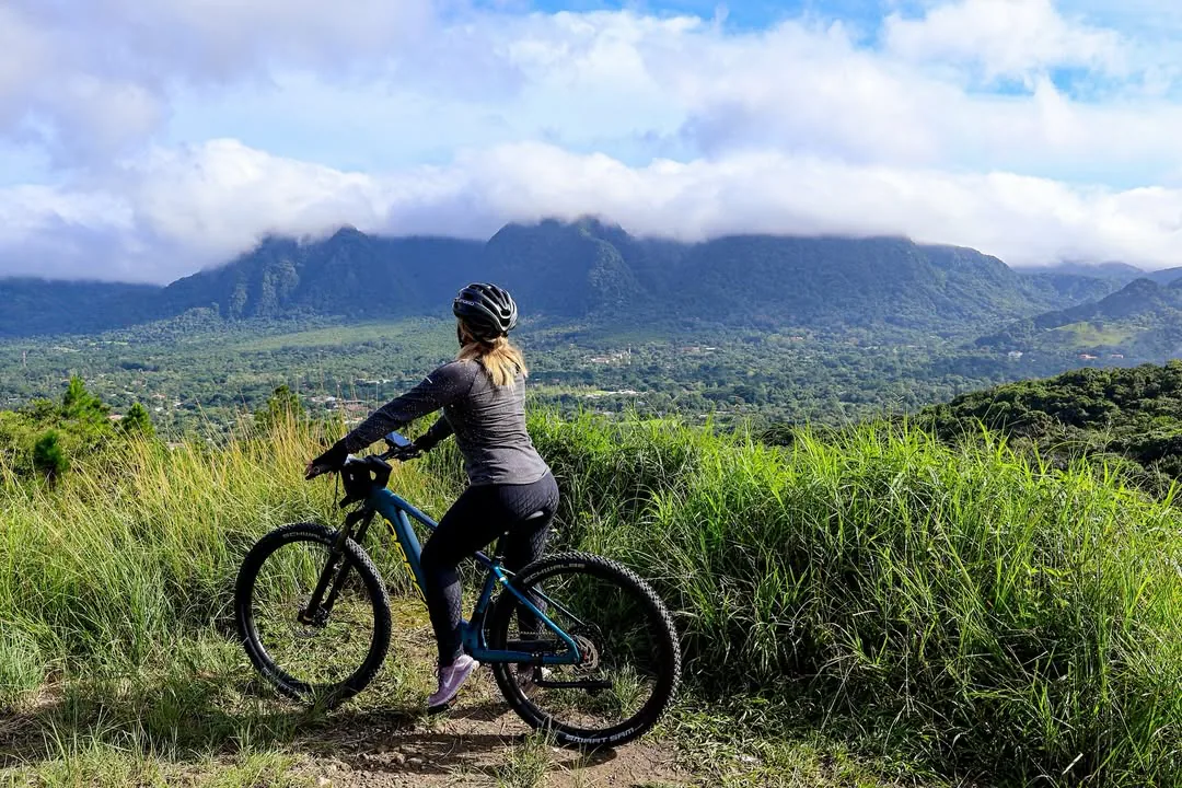
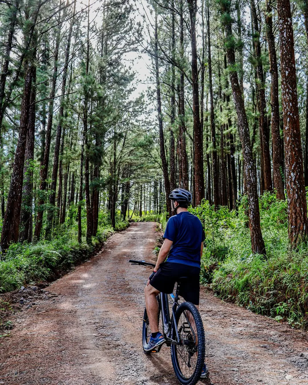
The walk from the town center to the trailhead takes 20–25 minutes on flat road, making it easily walkable if you are staying centrally. Taxis from town charge around $2–3 USD for the short ride. If you want to cover more ground in El Valle without worrying about transport logistics, renting an e-bike through E-Valley Bikes is a smart move — you can ride to the trailhead, lock up, hike, then continue to Chorro Las Mozas or the Sunday market on the same bike afterward.
Section 05Sunrise logistics — exact timing
The India Dormida sunrise hike is popular for good reason: the ridge faces east, the valley fills with morning mist, and the light on the crater walls is genuinely spectacular. But the timing advice online is all over the place. Here is what you actually need to know.
Sunrise in Panama varies by only about 30 minutes across the entire year. In the dry season (December–April), first light appears around 6:10–6:20 am. In the rainy season (May–November), it is slightly earlier, around 5:50–6:10 am. You want to be on the ridge — not starting the hike — at least 30 minutes before sunrise to catch the pre-dawn colour. That means reaching the summit by roughly 5:40–5:50 am.
The ascent from the trailhead to the summit takes 45–60 minutes at a normal pace for a fit adult. Add 20–25 minutes if you are walking from town rather than driving. Working backward:
- Driving to trailhead: Leave your accommodation by 4:30 am. Start hiking by 4:45 am. Summit by 5:45 am.
- Walking from town: Leave your accommodation by 4:00 am. Reach trailhead by 4:25 am. Summit by 5:25–5:35 am.
You will be hiking the lower forest section in complete darkness. A headlamp is not optional — it is essential. The concrete path at the base gives way quickly to root-covered forest trail, and without light you will miss footing on the first stream crossing. Bring a headlamp with fresh batteries, not a phone torch. A backup light source is worth the weight.
Crowds peak on weekend mornings in dry season (January–March). If you want the ridge to yourself, aim for a weekday, or plan to be on the summit before 6:30 am even on weekends — most day-trippers from Panama City do not start until 7:00 am or later.
Section 06Dry season vs. rainy season — month by month
Almost no guide addresses this properly. Here is the honest seasonal breakdown for the India Dormida hike, which matters significantly because the trail character changes dramatically between seasons.
| Month | Conditions | Trail State | Verdict |
|---|---|---|---|
| Jan – Mar | Dry, clear, 22–26°C | Firm, dusty in places, waterfalls lower | Prime season |
| Apr | Transitional, first rains | Good with occasional mud patches | Still excellent |
| May – Jun | Rainy season begins, frequent afternoon storms | Forest section muddy, stream crossings higher | Go in the morning |
| Jul – Aug | Heavy rain, high humidity | Slippery throughout, ridge can be cloud-socked | Manageable with care |
| Sep – Oct | Peak rainfall, wettest months | Very slippery descent, waterfalls impressive but trail eroded | Experienced hikers only |
| Nov – Dec | Rains tapering, clearing skies | Improving, some mud remains | Good from mid-Nov |
A few specifics that most guides miss entirely: In rainy season, the first stream crossing on the lower trail (roughly 400 metres from the trailhead) can rise to knee height after heavy overnight rain. It is not dangerous for adults, but it will soak your boots. Waterproof trail shoes or sandals you do not mind getting wet are worth considering from May onward. The descent through the forest is where most slips happen — the clay soil becomes extremely slick, and the concrete sections near the bottom are coated with algae. Trekking poles make a real difference on the way down in wet conditions.
The ridge section above the treeline is actually less affected by rain than the forest below, but it comes with its own rainy-season issue: cloud cover. On overcast mornings in September and October, you can reach the summit and see nothing but white. The views that make this hike worth doing can disappear entirely. If you are visiting in peak rainy season, check the forecast the night before and aim for a morning after a clear night — those tend to produce the best visibility before afternoon clouds build.
One upside of rainy season: the two waterfalls on the lower trail — Chorro El Escondido and Chorro Las Enamoradas — are dramatically more impressive. In dry season they are pleasant; in rainy season they are genuinely powerful. If waterfall photography is your goal, May through August is actually the best time.
Section 07The petroglyphs — what you are actually looking at
The Piedra Pintada (Painted Rock) petroglyphs are located right at the start of the trail, within the first few hundred metres of the entrance kiosk. Every guide mentions them; none of them explain what they are.
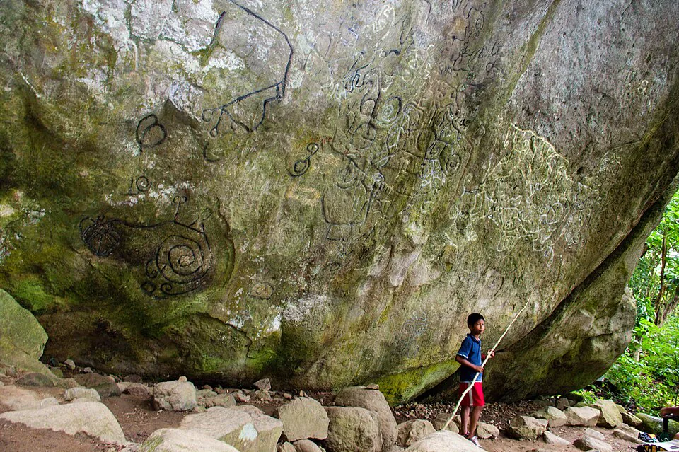
The petroglyphs are carved into a large basalt boulder — roughly 8 metres across — and consist of a series of geometric and zoomorphic figures: spirals, concentric circles, human-like forms, and what appear to be animal figures. They are attributed to pre-Columbian indigenous cultures of the Gran Coclé tradition, a cultural sphere that flourished in central Panama from roughly 500 to 1500 CE. The Gran Coclé people were sophisticated metallurgists and ceramicists — their gold work and painted pottery are among the finest pre-Columbian art in the Americas, with examples held in the Smithsonian and the Museo Antropológico Reina Torres de Araúz in Panama City.
The specific meaning of the Piedra Pintada carvings is not definitively established. Petroglyphs in this tradition are generally interpreted as territorial markers, ceremonial sites, or records of astronomical events. The spiral motifs appear across Gran Coclé sites throughout Coclé and Veraguas provinces. What is clear is that the rock was a significant site for the people who lived in this valley long before the Spanish arrived — and that the valley itself was inhabited continuously for at least a thousand years before European contact.
The petroglyphs are partially protected by a small roof structure. Do not touch them — the oils from hands accelerate erosion of the carved surface. The best light for photography is early morning when the sun is low and raking across the rock face, which is another reason the sunrise hike makes sense.
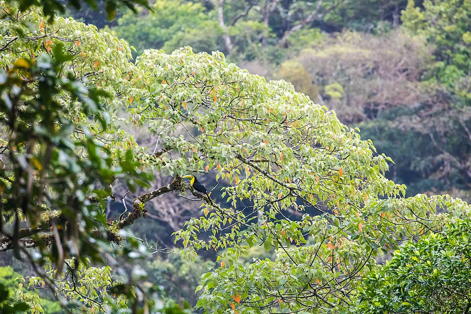
Above the petroglyphs, as you climb through the forest, keep your eyes and ears open. The India Dormida trail is one of the better birding spots in El Valle, particularly in the lower forest section. Resplendent Quetzals are occasionally seen in the upper forest, though they are more reliably found at higher elevations. More commonly spotted are the Slaty-tailed Trogon, the Blue-crowned Motmot (listen for its distinctive "hoot-hoot" call), and the Collared Aracari. The transition zone where the forest meets the open ridge is particularly productive — look for raptors riding thermals above the crater rim in the morning hours.
Section 08Safety, hazards, and what to do if something goes wrong
The India Dormida hike is classified as moderate, and that rating is accurate for the standard routes. But "moderate" in a Panamanian cloud forest involves specific hazards that are different from a temperate-zone moderate hike, and no guide online addresses them directly.
Slippery descent: The most common cause of injury on this trail is a slip on the descent through the forest section. The soil is clay-based and becomes extremely slick when wet. Even in dry season, shaded sections retain moisture. Wear trail shoes with actual grip — smooth-soled sneakers are genuinely dangerous here. Descend slowly, test each footstep on steep sections, and use trees and roots as handholds where available. Trekking poles reduce slip risk significantly.
Narrow ridge exposure: The ridge section near the India Dormida summit is narrow in places — a metre or less wide with steep drops on both sides. In normal conditions this is fine for any reasonably sure-footed hiker. In strong wind (common on the ridge, especially in dry season) or wet conditions, it requires attention. Do not rush this section. Children and anyone with a fear of heights should be aware of what they are getting into.
Stream crossings: There are one to two stream crossings on the lower trail depending on the route. In dry season these are ankle-deep at most. In rainy season they can be knee-deep and fast-moving after heavy rain. If a crossing looks genuinely dangerous — fast current, unclear bottom — turn back. No view is worth a swept ankle.
Sun and heat: The ridge section is fully exposed. Even at 600 metres altitude, the tropical sun is intense. Sunscreen, a hat, and at least 1.5 litres of water per person are non-negotiable. Dehydration and sunburn are far more common trail problems than falls.
Cell signal: There is cell signal on most of the trail, including the ridge section. This is genuinely useful — save the GPS coordinates of the trailhead before you start, and make sure someone knows your planned route and return time.
If you are injured on the ridge: The ridge section is the most remote part of the trail — roughly 1.5–2 km from the trailhead in either direction. If someone in your group is injured and cannot walk, call 911 (Panama's emergency number) and give your GPS coordinates. The trail is narrow enough that a stretcher evacuation would be extremely difficult; in a serious emergency, helicopter evacuation from the ridge is theoretically possible given the open terrain. This is a worst-case scenario, but it is worth knowing.
Security: There have been occasional reports of robberies on the more remote ridge sections, particularly the extended Caldera Route beyond Cerro La Cruz. These incidents appear to be infrequent and not recent as of 2026, but check with the trailhead staff and your accommodation before doing the full route solo. The standard India Dormida summit routes (figure-of-eight and Cerro La Cruz loop) are well-trafficked and have not had reported issues.
Section 09The natural pools — Chorro Las Mozas and the waterfall dip
There are two ways to finish this hike with a swim, and they are quite different experiences.
On-trail waterfall dip (Chorro El Escondido / Chorro Las Enamoradas): These two waterfalls are located on the lower forest section of the trail, roughly 500–800 metres from the trailhead. Both have small plunge pools deep enough for a cooling dip. They are accessible on any of the three route options, on your way back down. The pools are small — 2–3 people maximum — and the water is cold and clear. This is the easiest option: no extra distance, no logistics. Bring a swimsuit if you plan to use them.
Chorro Las Mozas (full Caldera Route only): This is a more substantial waterfall and pool complex located at the far end of the Caldera Route, near the Antón River. The pools are larger, the setting is more dramatic, and the swim is genuinely refreshing after a 6 km hike. Access requires completing the full Caldera Route — you descend the Cerro Violín trail and arrive at the river. From here you need a taxi back to El Valle town ($3–5 USD). The pools can be crowded on weekends, particularly with local families. Water quality is generally good but can be affected by upstream activity after heavy rain — use judgement.
If you are doing the shorter routes and want a proper swim, the Chorro Las Mozas can also be visited as a separate trip from town — it is accessible by road and does not require completing the full hike. Ask at your hotel for directions or take a taxi directly ($3 from town center).
Section 10How India Dormida compares to other El Valle hikes
El Valle has more hiking options than most visitors realise. Here is an honest comparison of the main trails, so you can decide how India Dormida fits into your time here.
| Trail | Distance | Difficulty | Best for | Verdict vs. India Dormida |
|---|---|---|---|---|
| La India Dormida (Cerro La Cruz Loop) | 3.5 km | Moderate | Views, petroglyphs, variety | The benchmark |
| Cerro La Silla | ~4 km | Easy–Moderate | Families, beginners, quicker summit | Better for novices |
| Cerro Cara Iguana | ~5 km | Moderate–Hard | Sunset views, fewer crowds | Harder, less variety |
| Cerro Gaital | ~8 km | Hard | Cloud forest, serious birding | For dedicated birders/hikers |
| Full Caldera Route | ~6 km | Moderate–Hard | Full-day adventure, swimming | Best full-day option |
Cerro La Silla is genuinely easier than India Dormida. The trail is shorter, the gradient less severe, and the exposed ridge section is less technical. It is the right choice for families with young children, older hikers, or anyone who wants a morning walk with good views rather than a proper climb. The views are less dramatic than India Dormida — you see the valley but not the full crater panorama — but it is a pleasant hike in its own right.
Cerro Cara Iguana is harder than India Dormida, not easier. The trail is steeper in its upper section, the footing is looser, and the summit is more exposed. It is best done in the afternoon for sunset views over the valley. If you have already done India Dormida and want a second hike, Cara Iguana is the logical next step.
Cerro Gaital is in a different category entirely — a serious cloud forest hike that requires a guide, significantly more time, and a higher fitness level. It is primarily of interest to birders; the quetzal sightings here are more reliable than on India Dormida.
The honest answer: if you only have time for one hike in El Valle, India Dormida is the right choice. It has the best combination of views, trail variety, cultural interest, and accessibility of any hike in the valley.
Section 11Getting to the trailhead — all your options
The Piedra Pintada trailhead is 2 km from the El Valle town center. Here are your realistic options.
| Method | Cost | Time from town | Notes |
|---|---|---|---|
| Walk from town center | Free | 20–25 min | Fine for daytime hikes |
| Taxi from town | $2–3 USD | 5 min | Best for pre-dawn starts |
| Drive / rent a car | Variable | 5 min | Parking limited on weekends |
| E-bike from E-Valley Bikes | From $30/bike | 10 min | Lets you combine with other sites |
The e-bike option deserves a proper mention here. The trailhead is an easy, mostly flat 2 km ride from town — you can lock up at the trailhead, do the hike, and then use the same bike to continue to Chorro Las Mozas, the Pozos Termales (thermal pools), or the Sunday market. E-Valley Bikes rents electric bikes with helmets, locks, and a route audio guide included, starting at $30 per bike — a practical way to turn the India Dormida hike into a full-day El Valle loop without depending on taxis.
Getting to El Valle from Panama City: the town is 2.5 hours by car via the Interamericana highway, turning north at the El Valle exit near San Carlos. By bus, take any bus toward Penonomé or Santiago from the Albrook terminal in Panama City and ask to be dropped at the El Valle turnoff (La Mesa), then take a connecting bus or taxi up to El Valle. Direct buses to El Valle also run from Albrook on weekends. The total bus journey takes 2.5–3 hours and costs around $4–5 USD. If you are coming from Coronado or the Pacific beaches, El Valle is only 45–60 minutes north.